
Instagram Updates Map Feature to Improve Location Sharing Transparency
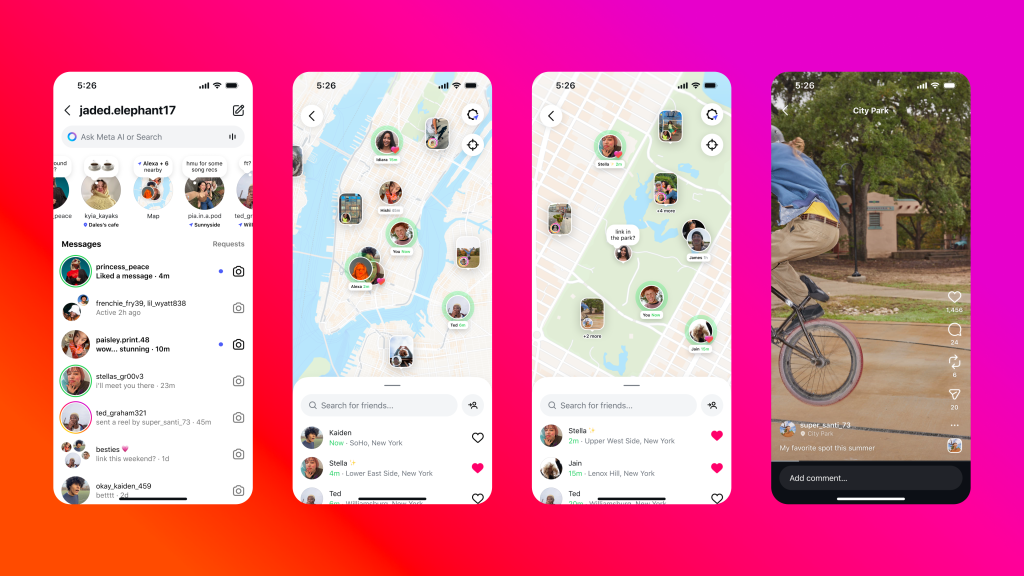
Instagram is rolling out a redesigned map interface aimed at making location sharing clearer and more user-controlled. The update introduces visual indicators, simplified toggles, and contextual prompts that help users understand when their location is being shared and with whom.
Key Changes
- Active Location Indicator: A new icon appears at the top of the map when real-time location sharing is active. This allows users to quickly identify and disable sharing if needed.
- Inline Sharing Controls: Users can now manage location settings directly from the map view, eliminating the need to navigate through multiple privacy menus.
- Post-Level Prompts: When tagging a location in a post or story, Instagram will prompt users to confirm visibility settings, showing whether the tag is public, limited to followers, or restricted to close friends.
Privacy Enhancements
The update is part of Meta’s broader effort to improve digital safety and user awareness. By making location sharing more transparent, Instagram aims to reduce accidental exposure and give users more control over their data. The platform is also testing a “location blur” feature, which allows users to tag general areas (such as neighborhoods or districts) instead of precise coordinates.
User Experience Improvements
- Map Discovery Feed: The map now includes a curated feed of nearby content, with filters for trending locations, events, and tagged businesses.
- Location History Management: Users can view and manage their past location tags, with options to delete or adjust visibility retroactively.
- Cross-Platform Sync: Location settings now sync across devices, ensuring consistent privacy controls whether users are on mobile or desktop.
Rollout Timeline
The feature is currently being tested in select regions and is expected to roll out globally by late October 2025. Users should update to the latest version of the Instagram app to access the new controls.